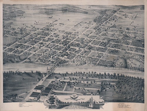
Did you know that “Lamartine” was a proposed name for Waco? Or that “Waco Village” was once in Milam County? Do you know where Waco Female College was? Explore Mapping Waco: A Brief History, 1845-1913 to learn the answers to these questions and more.

In this physical and digital exhibit, maps represent the changing landscape of Waco from its earliest days in the mid-1800s to the boom years of the late 1910s. Selections include bird’s-eye views of the city drawn in the late 19th century; illustrated maps of new additions and suburbs; and blue lines of individual plats on Waco city streets.
“We hope this exhibit of early Waco maps will spark an interest in local geography and history,” said John Wilson, director of The Texas Collection. “It may also begin a dialogue regarding other maps and resources that are in the community and could be shared.”
The maps are on display in The Texas Collection within Carroll Library, which is open from 8-5, Monday through Friday. We hope you’ll come and see them in person AND take a zoomed-in look at them on the Baylor Digital Collections site. The physical and online exhibits are up now and will be on display through December 2012.
We collaborated with the Digitization Projects Group on preparing the digital component of the exhibition–read about the digitization and curation process on Baylor Digital Collections’ blog–and enjoy the maps!