The collections we maintain take many forms: photographs, maps, books, coins, even bells from Spanish missions have found their way into our holdings! All these materials help us tell the stories of Texas in a way that focuses on documented facts.
When you combine that with oral memoirs and the power of creative fiction from works by authors like Dorothy Scarborough, you begin to see the rich tapestry that is the history of the Lone Star State.
Even our best efforts to collect and preserve stories can only go so far. There are gaps and blind spots in our holdings, and areas where we have an over-abundance of materials (that’s why we politely decline to take any more copies of Baylor’s Roundup yearbook). To enrich our collections and tell more diverse stories, it is important to reach out to ask for your help in locating and preserving resources that document Texas and Waco in more complete ways.
A Shifting Waco Landscape
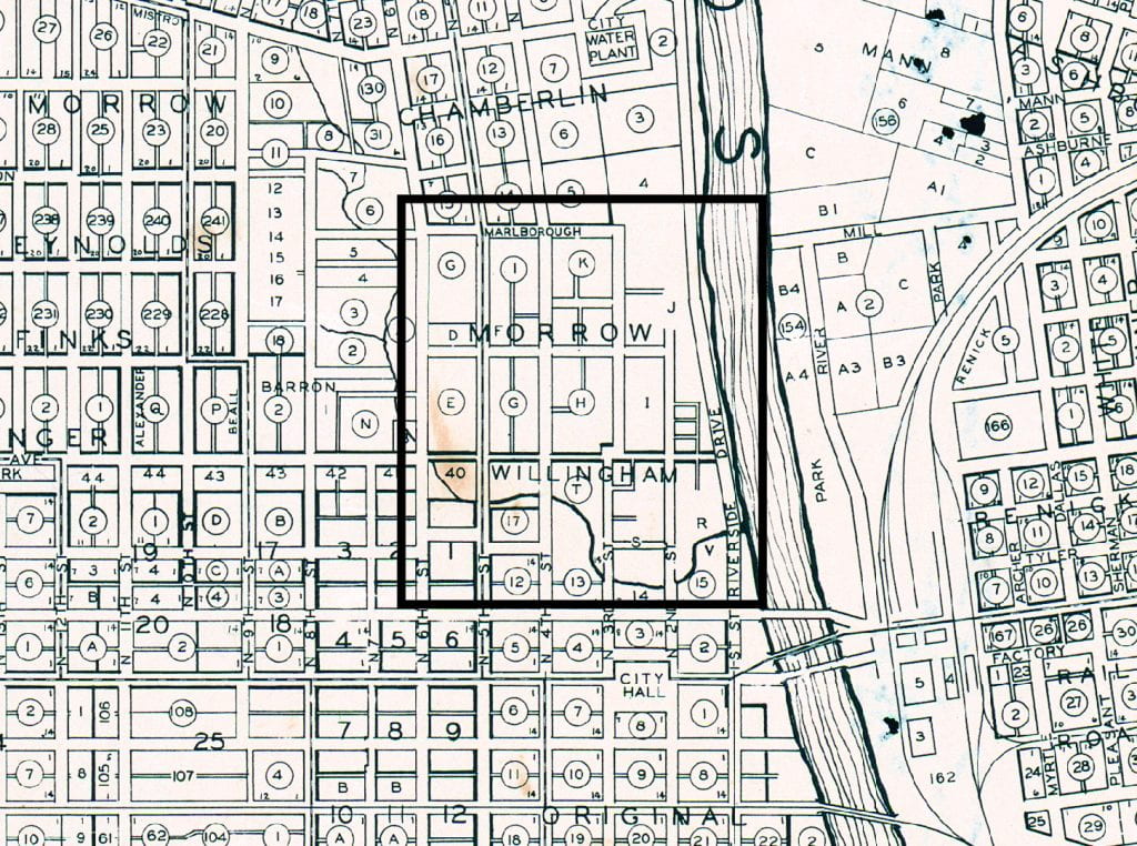
The Waco neighborhood known colloquially as Calle Dos (for its location centered around Second Street) can be seen on some of the earliest maps of the city. Interrupted by Barron’s Branch creek as it flows into the Brazos River, the area sits on land originally deeded to R.W. Goode, M. Johnson, and R.W. Lusk, among others. In time, the area became home to the largest legal red light district in the United States, known as The Reservation.


When The Reservation was officially shut down as part of a deal for Waco to procure military installations upon America’s entry into World War I – Camp MacArthur and Rich Field, specifically – the area became home to a wave of immigrants from Mexico and Central and South America. These numbers swelled as people fled the chaos of the Mexican Revolution and found housing in Calle Dos to be more affordable than other options in the city.
Subsequent events in the Calle Dos story include destruction wrought by the 1953 Waco Tornado, clean-up efforts following the storm, and Urban Renewal from the 1950s-1970s. The end result is today’s largely open tracts of land and some remaining landmarks like St. Francis on the Brazos Catholic Church and Indian Springs Middle School.
Remembering a Vibrant Community
In recent years, there has been interest from community advocates to create a historic marker for Calle Dos, perhaps near the former community gathering place called La Pila. This artesian well-filled fountain served as a source for water and connection for the area’s residents before it was covered over with rubble created by the 1953 tornado. These efforts have been slow to gain traction, partly because the documentation of the lives that once were part of Calle Dos are not readily accessible, but scattered among family papers, small archives, and the memories of elder Wacoans.
The Texas Collection would like to take this opportunity to call on our friends in Waco’s Latino community to partner together to locate, document, and preserve the stories of Calle Dos. We are proud to offer our assistance with training, access to our current resources, and, if asked, provide a permanent home for documents, photos, and other materials related to this vibrant part of Waco’s history.
If you have materials related to Calle Dos and would like to discuss how The Texas Collection can help ensure that they are included in our archives on the history of Waco, please reach out to txcoll@baylor.edu or call us at (254) 710-1268.
——-
Maps Cited
Map of Waco City and Vicinity (1869) – View full map
Official Map of the City of Waco and Suburbs (1891) – View full map
Map of Waco, Texas and Additions, 1930 – View full map
Map of City of Waco, Texas (1949) – View full map
No Comments