by Rachel DeShong, Special Event Coordinator and Map Curator
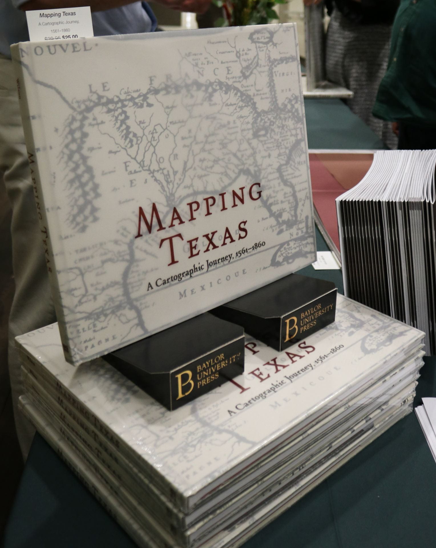
On November 14th, The Texas Collection hosted its annual fall lecture which focused on the newly published book Mapping Texas: A Cartographic Journey, 1561 to 1860. This project, published by Baylor University Press, was a collaborative work written by John S. Wilson, Baylor’s Interim Dean of Libraries and Director of The Texas Collection, Sierra M. Wilson, Print Production Coordinator for the University of Chicago Press, and Rachel DeShong, the Map Curator at The Texas Collection. Mapping Texas features 44 full color maps from the Frances C. Poage Map Room in the style of a large, coffee-table book. At the lecture, the authors explored the origins of the iconic boundary of Texas, highlights from some of the more prominent maps, and the practical and artistic aspects of map cartouches.
The first map the speakers analyzed was Nueva Hispania Tabula Nova[1], 1561. This is one of the earliest maps in our collection and is one of the first maps that accurately depicts the Texas coastline. The map is notable because of the various editions – also referred to as “states” – that exist. The third edition, which The Texas Collection owns, is distinguished by the introductions of new place names and the illustration of a ship in the middle of the Pacific Ocean.
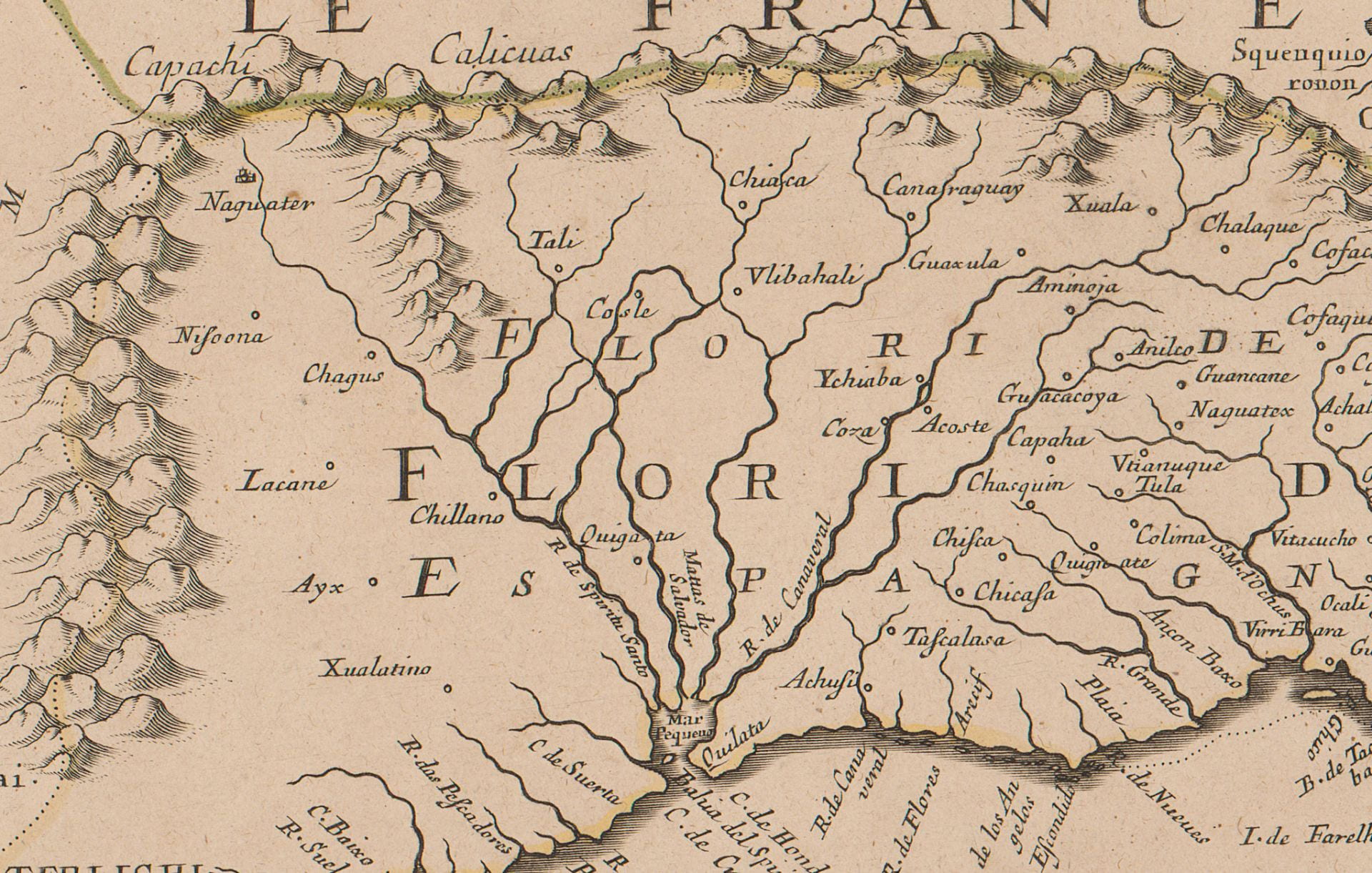
Afterwards, John Wilson introduced Le Nouveau Mexique, et la Floride: Tirées de Diverses Cartes, et Relations[2], 1656. The map’s creator, Nicolas Sanson, was the Royal Cartographer to King Louis XIII. Sanson is known for his rejection of the ornate Dutch style of cartography and basing his maps on verifiable information. Ironically, one of the most blatant errors is Sanson’s portrayal of California as an island, a complete reversal of the traditional depiction one hundred years prior. Although Sanson includes the relative proximities of indigenous tribes, he places most of the Caddo tribes too far east into present-day Louisiana.
The next map discussed was created by Jose Antonio de Alzate y Ramirez, a noted Mexican priest and scientist. Nuevo Mapa Geographico De La America Septentrional, Perteneciente Al Virreynato De Mexico[3], 1768 has two editions: the French and the Spanish. The French edition, of which The Texas Collections owns the second state, is differentiated from the Spanish by the “ph” in the word “Geographico,” the box surrounding the title, and the spelling of the Pacific Ocean. The Spanish edition is noted for being the only map Spain published of the New World/New Spain during the eighteenth century. Alzate did not introduce much new information in the Texas region, however, this is the first map to label the area as “Provincia de Texas.”
Texas finally begins to form its iconic boundaries in the publication of the next map. Alexander von Humboldt’s Carte Générale du Royaume de la Nouvelle Espagne[4], 1809 was the first map to chart the course of the Rio Grande River correctly. Cartographers during this time period relied on information from the accounts of explorers, surveyors, priests, traders, etc. to draw the maps. Rarely did they ever visit the places they created on paper. Humboldt was unique in this regard in that he actually visited the places he drew in his maps.
Rachel DeShong presented the next map entitled Map of the United States with the Contiguous British & Spanish Possessions, 1816. This work by John Melish is one of the first maps to reflect territories of the United States stretching from the Atlantic Ocean to the Pacific Ocean. The 1818 edition of the map was cited specifically in the Adams-Onís Treaty of 1819 which defined the boundary between Spanish America and the United States. The Sabine River and the Red River were chosen as the eastern and northern boundaries of Texas. However, errors in Melish’s map caused border disputes well into the twentieth century.
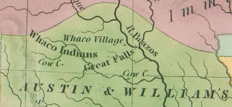
After a few centuries of exploration and political upheaval, one can begin to see Texas taking a familiar form in the next two maps, A Map of North America, 1822 by Henry Tanner and Vereinigte Staaten von Nord-America[5], 1834 by Adolf Stieler. The final two maps presented at the lecture, Texas, 1835 by Thomas Bradford and A New Map of Texas with the Contiguous American & Mexican States, 1836 by J. H. Young, portrayed the land grants of revolutionary Texas and not so subtly highlighted some of the opportunities immigrants would have if they settled in Texas. Interestingly, Waco appears on both the latter maps.
Sierra Wilson concluded the lecture with a discussion of cartouches, the decorative emblems that frame map titles. She discussed at length the artistic value of cartouches and examined parallel examples of cartouches in architecture and book publishing.
If you are interested in viewing the original maps, please contact Rachel DeShong at Rachel_DeShong@baylor.edu. Mapping Texas: A Cartographic Journey, 1561 to 1860 is available for purchase at the Baylor University Press.
Notes
[1] Translates to A New Map of New Spain
[2] Translates to New Mexico and Florida from Various Maps, and Relationships
[3] Translates to New Geographical Map of North America, Belonging to the Viceroyalty of Mexico
[4] Translates to General Map of the Kingdom of New Spain
[5] Translates to United States of North America
No Comments