
Project Title: Impoverished Youth Index & Unused Church Properties
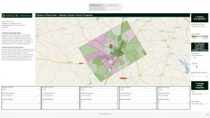
Description:Identify unused church properties in McLennan County, Texas that may potentially be used to support social service targeted at impoverished youth. This visualization was built specifically for a graduate course cross-listed as Social Work/Truett Seminary.
Researchers Involved:
- Dr. Stephanie Boddie, Baylor School of Social Work
- Joshua Been, Baylor Libraries
- Sinai Wood, Baylor Libraries
Procedure:
- Prepare data for Tableau
- Download 5-year American Community Survey (ACS) data by Census block group data from IPUMS NHGIS.
- Download additional data by Census tract data from Data Planet (commercial database).
- The Data Planet data was all proportional/currency format so values were passed to the constituent block groups and then merged with the ACS data table.
- QGIS application used to join combined variable table with Census TIGER block group shapefile.
- Download Texas Academic Performance Reports (TAPR) from Texas Education Agency for elementary schools in McLennan County.
- QGIS application used to spatially join each block group with the school’s data within the school’s attendance zone.
- Parcel shapefile for McLennan County downloaded from McLennan County Appraisal District: Open Records.
- QGIS application used to filter parcel shapefile for a religious organizations.
- Used the ‘merge shapefiles to one’ function within QGIS to combine block group shapefile containing variables and filtered parcel shapefile.
- Build visualization within Tableau
- Create dual axis map with one axis for block groups and one for parcels.
- Add parameters and calculated fields to hold weights and calculated index.
- Publish.
- Due to student request, we added a tab to a second dashboard with aerial imagery. The aerial imagery was provided by USDA NAIP.
Impoverished Youth Index & Unused Church Properties